
By October of 1917, Will Grummett had been on the Persian front for just over two months. He’d spent some of that time confined to a segregation camp as part of an effort to defeat an epidemic of diphtheria. He was released in late July and had been engaged from then primarily in training exercises in preparation for the upcoming season of “active campaigning” against the Turkish army.
Since April, both armies had been nearly inactive due to the intense heat. The British Commander, General Maude, noted in a dispatch describing this period that, “…movements could not be undertaken by either side without grave risk of incurring substantial casualties from heat stroke and heat exhaustion,” (Gen. Maude, London Gazette, Jan. 8, 1918). Just before the halt in the fighting, Maude and his army had driven the Turks eastward to the foothills known as the Jebel Hamrin, and south of the Diyala River just beyond the village of Deli Abbas on the north side of the river. (see Map 1 below, Turkish lines are indicated by the brown line).

In post 7, Mesopotamia, it was pointed out that the people of this ancient land invented and extensively employed the process of irrigation. And, while it had eventually brought ruin to many sites, it continued to be used on lands better suited to the practice. The land south and west of the Jebel Hamrin is just such a place. It is crisscrossed by a network of irrigation canals. For millennia, water diversions, canals and water control structures have brought water to land otherwise incapable of growing crops. Sinsil, Khurassan, Marut, Ruz, Haruniyah, Abu Hadid, Ruhaiya, Aghadir, Mudarako, Shaharaban are the names of some of the major and minor canals that divert water from the Diyala River and carry it west and south to irrigate crop lands and supply communities.
The main control structures for the canal system are located where the Diyala River emerges from the Jebel Hamrin near the town of Mansirya (marked with a red diamond in the map above). These canals and their control structures are the lifeblood of the region. He who controls the canals controls the land. From their position in the Hamrin foothills and below the town of Mansirya it was the Turkish army that had their hands on the water control structures in October of 1917.

Recognizing the canals importance, General Maude issued the order in early October, “to clear the Turks from the left bank of the Diyala (River) and occupy the Jebel Hamrin astride of that river, in order that the control of the canals might be in our hands.” (Gen. F.S. Maude, London Gazette, Aug. 26, 1918).

For the Norfolk Regiment, the special objective within the plan was, “…to secure the crest of the range (the Jebel Hamrin) where the cart road crosses it.” (Petre, 2003). I have tried to make sense of this cryptic objective and even with the maps from the era I can find no single obvious or so named “cart road”. All of the roads in the Jebel Hamrin are cart roads at best, most are simple trails, passable only by foot or on horseback. The actual road aside, I suppose the point was to push the Turks from the high ground and out of the hills. From the beginning of these hills just beyond a canal called Ruz and the Talib Bridge on the Shaharaban Road (see Map 2 above) to the crest of the range was about two miles of increasingly rugged and difficult country.

The hills of the Jebel Hamrin are limestone with a maximum elevation of 1600 feet and little vegetation. They are the foothills of their parent range, the Zagros Mountains which extend for 1000 miles along the border with Iran and Turkey.

General Maude’s plan to seize control of the canals and push the Turks from the Jebel Hamrin began with an attack on the forward Turkish positions at Deli Abbas. Meanwhile, his main force, including the Norfolk Regiment, attacked the Turks holding the crest of the Jebel Hamrin. General Maude summarized the events simply in his dispatch, “These measures had the desired effect of dislodging the enemy from a very strong position with extraordinarily few casualties in my force…” (Gen. Maude, London Gazette, Aug, 1918). It would seem that the Turks yielded the high ground almost without a fight, and they abandoned the hills, retreating north-east along the Shaharaban Road (see Map 2 above) with the Norfolk Regiment in pursuit.
It could, very easily, have been a very bloody and difficult fight for each hill. I am sure Will was relieved, as never before in his life, as they marched through those hills with the enemy retreating in front. Now he could only think, when will they turn and stand, and how easy is it to get caught in crossing fire from the tops of these hills?
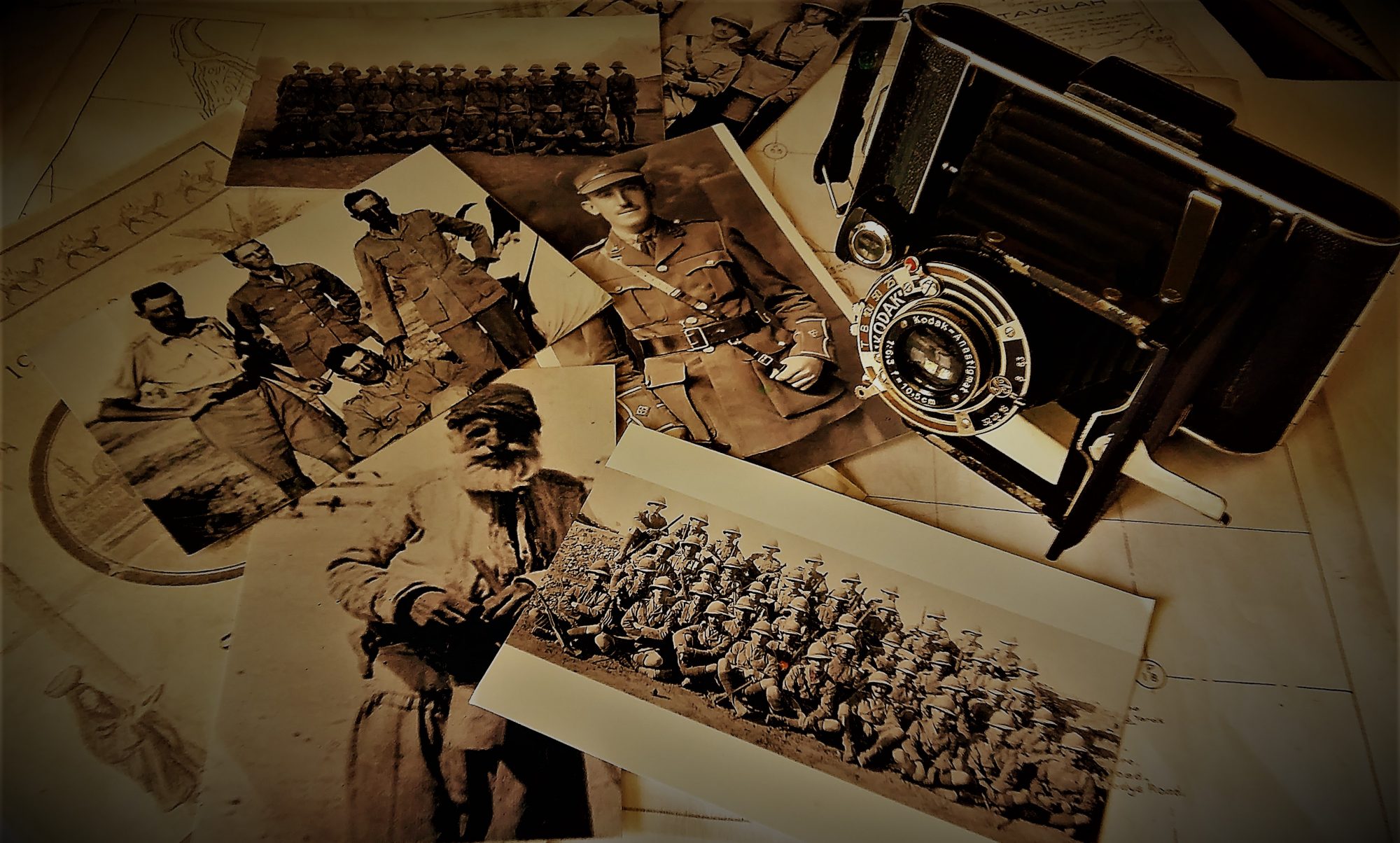
Of course, simply moving through the hills wasn’t easy; the Shaharaban Road was nothing more than a trail, and the Regiment was moving men, equipment and artillery. In the photos below, Will captured the Regiment as it moved men and guns through the hills and the plains in pursuit of the enemy.


They followed the enemy for about six miles through the rugged Jebel Hamrin. The hills gave way to the valley of the Kurdarrah River, and a broad plain beyond. The Norfolk Regiment marched across this plain towards Kizil Robat on the morning of October 20th. When they were within range of the village, the Turks opened fire with their heavy guns. The Regiment withdrew out of range to observe and to determine the best way to take the town of Kizil Robat. While they were working out a strategy, and reconnoitering the Turkish defence, the Turks retreated up the Shaharaban Road to Khanaqin (see Map 1 above).
Will had just experienced his first time under enemy fire. It wouldn’t have taken the Regiment long to withdraw out of range, but it must have seemed a very long time with artillery rounds dropping in among the column.

The Norfolk Regiment did not pursue the Turks past Kizil Robat. The attack at Deli Abbas forced the enemy back into that portion of the Jebel Hamrin beyond the town of Mansirya, abandoning the headworks of the canals. Maude’s objectives were achieved; the Turks were driven from the southerly portion of the Jebel Hamrin, and the canal system was now in British hands.
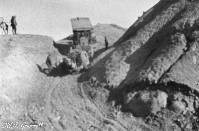
Maude’s first action following this success was consistent and predictable. He gave orders to incorporate the hard-won geography into the existing system of transport and communications. To this end 75 bridges were constructed in the immediate region to provide crossings through the maze of canals, and the Jebel Hamrin was, “pierced by a very complete and convenient number of roads for wheeled traffic.” (Gen. Marshall, London Gazette, Aug. 26, 1918) Will took part in this work and documented temporary bridge building and some of the hard work of road building in the hills.


The Norfolk Regiment then established a camp near the Kurdarrah River (see Map 2), and it was here that they would have received the news, in late November, that their Commander, was dead.

General Maude had died on November 19th having contracted cholera. General W.R. Marshall assumed command of the Mesopotamian Expeditionary Force and began to form plans of his own for the continued pursuit of the Turks.
By the end of November, General Marshall had determined to push the Turks further back from the Diyala River above the town of Mansuriya (see detail Map 2b below – the dashed line indicates Turkish positions) and beyond the passes of the Jebel Hamrin at Abu Zenabil and the Sakultutan, to as far north as Kara Teppeh (See Map 1 above for the relative position of Kara Teppeh). Marshall ordered his units to engage the Turks along a broad front from Mansuriya to just beyond the town of Kizil Robat to the north-east.

The Norfolk Regiment began their portion of the action just above the town of Kizil Robat on December 2, 1917. They were to cross the Diayla River moving westerly, and to push the enemy toward Kara Teppeh. They discovered that the bridge over the river had been destroyed by the Turks as they continued to retreat. The Regiment made an attempt to ford the river at the bridge site, but found the crossing impossible in the deep, strong current. Men and equipment were being swept downstream. Fortunately, the enemy was prevented from firing upon the ford, “thanks to a very efficient barrage which prevented the enemy opening fire.” (Petre, 2003)
Installation of a temporary pontoon bridge was ordered (photos below document a similar action) but there were few pontoons available. As a result, the temporary crossing was limited, and the day consumed in getting the Regiment across. By the time they were on the opposite side, the Turks had pulled well back from the River to the west and north-west.


In addition to destroying bridges, the Turks also made certain to leave nothing behind which might assist their pursuers. The photo below is likely a Turkish fuel and ammunition dump set afire as the Turkish force retreated.

On the other end of this broad front, the Turks abandoned the Abu Zenabil and the Sakultutan passes in the hills as they also retreated to the north. To buy time as they retreated, the Turks flooded the low ground where the Nahrin and the Diyala Rivers meet . (Gen. Marshall, London Gazette, Aug. 26, 1918). Despite this difficulty, General Marshall noted the area was occupied by his forces on December 3rd.
The Norfolk Regiment was back at Kurdarrah Camp by December 3rd, having achieved their portion of the objective. Now, General Marshall’s plan was to bring units together in a combined column to march on Kara Teppeh. The Norfolk Regiment was not required for this part of the campaign. Two of the regiments’ platoons were. They were given the job of ensuring the Turks had abandoned the pass at Abu Zenabil and the nearby village of Tawilah. It seems likely that the main British force skirted the area near the Abu Zenabil pass due to the flooding by the Turks and now wanted a report to be certain there would be no surprises as the army came together to march on Kara Teppeh. If there was anyone left behind, it would be a small force, but in those hills a small force might do a lot of damage.
On December 4, the Norfolk Regimental diary records, “orders received for two platoons to proceed to Sawiyah (Sadiyah) and spend the night there; ford river in the early am of 5th , clean up area Tawilah, Abu Zenabil, recross the Diyala and rejoin battalion at Kurdarra River Crossing Camp evening 5th.” The assignment was given to 2nd Lt.’s Grummett and Hayes.
The platoon is a unit of between 24 and 44 men and is the largest unit that can be commanded by a 2nd Lieutenant (General Staff (b), 1917). It is a mobile, lightly armed unit, carrying rifles, rifle grenades, and the Lewis automatic rifle. The command structure of a platoon includes the Lieutenant and the non-commissioned officers, most notably a First Sergeant capable of both advising on and implementing the platoon commander’s orders and direction. Responsibility for the mission and the men, however, began and ended with the Lieutenant.

On the morning of the 5th, Will and a 2nd Lieutenant Hayes and their platoons set out on foot from Sadiya and made for Tawilah. Map 3, below traces my best guess as to the route they took into and out of the Jebel Hamrin.

They had marched about seven miles the previous day from Kurdarrah up the Shaharaban Road past Kizil Robat to Sadiyah. Much of the nine or ten miles from Sadiyah to Tawilah would have been only slightly more difficult marching, following ancient trails skirting the Diyala River. Just before Tawilah they would have encountered the low area below the confluence of the Nahrin and the Diyala rivers, that the Turks had flooded during their retreat days before.
At this point, the two platoons may have separated to be able to enter the village from two vantage points. Both platoons forded the Diyala River just outside of the village. Will ordered a halt and sent men ahead to reconnoiter the village. He issued the order for the rest of the men to proceed, slowly, spread out, and under cover as much as possible given the terrain. At a safe distance, he would have brought the platoon to a halt and awaited the word from his scouts. The scouts reported: no Turks in the village. Will brought the platoon cautiously into Tawilah, rejoining Lieutenant Haye’s and his platoon. There were probably brief discussions with locals about when the Turks had left, if there were any remaining, and if there were any Turks at Abu Zenabil about a mile to the west.
In order to avoid the flooded area (marked in yellow dashes on Map 3 above), I think Will and Lieutenant Hayes opted to skirt the flooding, recrossing the Diyala where they had crossed to enter Tawilah, and proceeded to the north and west to the point where the Nahrin meets the Diyala River. They likely crossed the Nahrin River and made their way south to the Abu Zenabil pass. (Alternatively they may have gone south, around the flooding and found a ford to cross the Diyala and approached Abu Zenabil from the south.) At the pass they found nothing; the Turks had completely abandoned it in their retreat. The route back to Kurdarrah Camp may have been north and back over the Nahrin River or perhaps to the south down the Diyala River, skirting the flooding, then crossing the river at a suitable ford. From there they would have followed the edge of the flooding using the high ground, making their way toward the Kurdarrah River valley where the ground would be less hilly and perhaps easier going. By the time they reached Kurdarrah Camp on the evening of the 5th they had covered about 25 miles- half of it in very difficult country.
On his return to camp, Will reported that he had reconnoitered Tawilah and the pass at Abu Zenabil and, “there was nothing to clean up,” the Turks had abandoned both the village and the pass. He added, “the crossing (of the Diyala River) at Tawilah was a bad one.” (Regimental diary, December 5th, 1917). With this information General Marshal’s army could, confidently, push forward and engage the Turks at Kara Teppeh. They did, and the Turks retreated again, this time to Kifri.
As the rains came late in December and early in the new year, the Norfolk Regiment camped either at Kurdarrah or Beled Ruz or was in transit between the two. It wasn’t until April 24th that the Regiment was engaged in a new operation that saw them cross the Diyala River and march 45 miles north toward the town of Kifri. The objective of the operation is unclear, but appears to have been part of the effort to drive the Turks further north. The enemy was neither seen nor engaged, the regimental history noting that, “The Norfolk Battalion had no fighting in the operations…”(Petre, 2003)
As April progressed, the hot weather began to resume its grip over the land, preventing any further concerted action against the Turks: at least until the following October of 1918. To provide officers and men some relief from the difficulties of life at the front, and to give them something constructive to do, they were sent in rotations to India to attend training schools and to rest.
Toward the end of April of 1918 Will posed with his immediate senior officers for a photo. Gone is the nervous boy who posed for the officers group photo at Baqubah in September of 1917 (see post #8). In his place is a lean, tired, but confident officer, the lower half of his face deeply tanned and lined from constant exposure to the relentless elements of this unforgiving land.

Sometime in early May, Will received an order from the Headquarters Embarkation Commandant directing him to, “…proceed to Pachmari, India to join the School of Musketry.” The Norfolk Regimental Diary notes that on May 11th, 1918, “W.J. Grummett and Sgt. Woods left to proceed to India to attend the School of Musketry.”
After 10 months at the front, Will’s first tour of duty in Mesopotamia was over.
Next installment coming in September, At Pachmari, India
